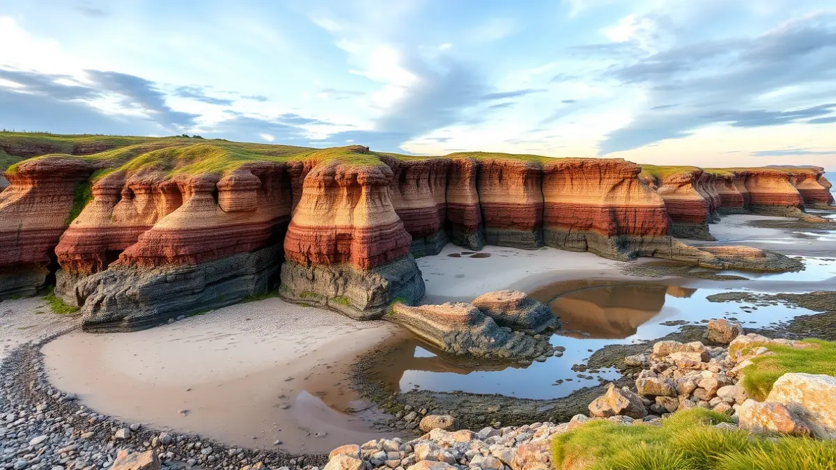
Visiting the Goikomendiazpi cove in Barrika reveals one of the greatest geological treasures of the Bizkaia coast: the flysch. To enjoy this landscape created by nature in its purest state, one only needs to descend the beautiful stairs from the Barrika picnic area.
This landscape actually condenses about a hundred million years of geological history. The most important tip to make the most of the visit is to wait for low tide, when the famous tidal flat appears, allowing visitors to walk among the flysch, as it practically disappears at high tide. Dawn or dusk are ideal times to visit, offering fewer crowds and spectacular light that reflects stunning colors on the rocks.
Another essential requirement is to wear non-slip footwear, as the ground can be slippery. Barrika's flysch often appears in guides as a secondary reference compared to Zumaia's flysch, in Gipuzkoa, which has greater media visibility and the support of the Basque Coast Geopark. However, Barrika's folds offer something Zumaia does not: the possibility of walking on the tidal flat and reading the geology at ground level, not just observing it from above.
“"Respect the environment. Do not take stones or leave trash. It is a unique place and we must preserve it."
The term flysch, of German origin, means “to flow” or “to slide,” and describes a sequence of sedimentary layers formed by the alternation of hard rock and soft material deposited in deep marine environments. In Barrika's case, these layers correspond to the Upper Cretaceous, between the Campanian and Maastrichtian, and emerged to the surface during the so-called Great Collision: the clash of the small Iberian plate against the European plate, which also raised the Pyrenees and defined the current geography of Euskal Herria. The visible result today on Barrika's cliffs are V-shaped folds and layers arranged almost vertically.
This area is part of the Flysch Bizkaia corridor, which extends from Getxo to Bakio, passing through Sopela, Barrika, Gorliz, and Armintza, and concentrates 16 Geological Interest Sites recognized by the Basque Government. Barrika's folds are one of them and constitute something specialists point out as unusual in any other part of the Cantabrian coast. Access from the Barrika picnic area (ample parking, picnic tables, views of the Cantabrian Sea) is easy: stairs lead directly to the beach.