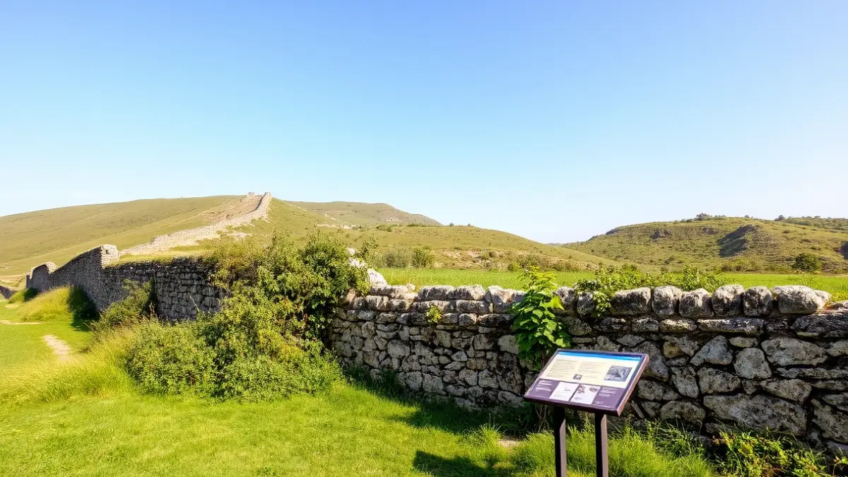
The Iron Belt, a defensive line spanning over 80 kilometers built during the Spanish Civil War to protect Bilbao and its surroundings, holds significant historical, archaeological, and symbolic value. In Sopela, the main remnants are located in the areas of Areneburu, Munarrikolanda, and Santa Marina, within the mountain range shared with Berango and Urduliz.
The first phase of the project was completed in 2024, focusing on researching the historical context of the defensive line and documenting the elements present in the municipality. As a result, a Geographic Information System has been created to locate the components of the Iron Belt and assess their condition.
During 2025, the initial actions have begun, including clearing access points, removing undergrowth, and installing directional signs in various locations, always under strict archaeological supervision. Additionally, informative panels have been designed to disseminate knowledge about this heritage.
In the coming months, looking ahead to 2026, the City Council will continue to define the necessary consolidation work on the structures. Furthermore, plans include completing the signage, installing interpretive and accessible panels, and enhancing public outreach through routes, educational materials, and guided tours.